November 1–2, 2006 meeting
- Draft Agenda (PDF)
Pre-meeting reading materials
- SBSP Status Report (PDF)
- Schedule of Science Team Activities in 2006 (PDF)
- Small Group Discussion (PDF)
- Sediment Marsh Group (PDF)
- Water-Sediment Quality Group (PDF)
- Higher Trophic Levels Group (PDF)
- Proposal for Conservancy’s Role in Long-Term Institutional Structure (PDF, Sep. 2006 draft)
- 2006 Science Symposium Summary and Agenda (PDF)
November 7–8, 2005 meeting
- Summary of Responses to November ’05 Recommendations (PDF)
- NSP Recommendations from November ’05 meeting (PDF)
- Agenda (PDF)
- SBSP Status Report (PDF)
- SBSP, Short-term Data Needs, 2003-2005 Draft Final Report, U.S. Geological Survey, Western Ecological Research Center (PDF)
- Proposal for Island Pond Adaptive Management Studies (PDF)
- Conflict of Interest Statement (PDF)
- SBSP: Revised Draft Adaptive Management Plan, October 2005 (PDF)
June 13–14, 2005 meeting
- Summary of Responses to June ’05 NSP Recommendations (PDF)
- Science Panel’s Observations & Recommendations (PDF)
- Meeting Presentations
- Agenda (PDF)
-
Pre-meeting Reading
- Bay Nature article
- Mercury in Every Mix (CALFED science article)
- Initial Stewardship Plan status report (March 2005)
- Landscape-scale assessment progress update (June 2, 2005)
- Draft Adaptive Management Plan—June ’05 edition (June 3, 2005)
February 28, 2005—Design Charette
The National Science Panel spearheaded the concept of a design charette to lay out a long-term vision that can guide the project over several decades, and bring existing experience to bear on both the identification of important research issues and opportunities for early restoration successes.
- Final report (PDF)
October 12 and 13, 2004
Please note that the Science Plan is a draft document, particularly relative to the synthesis sections. Some of the syntheses are still in progress. Some of the key sections of the Science Plan to note in particular are sections V., VI., and VII., which relate to performance standards, our predictive abilities, and key uncertainties.
- Meeting Summary (PDF)
- Meeting Agenda (PDF)
- Draft Science Plan—Cover and Table of Contents (PDF)
- Draft Science Plan (PDF)
- Adaptive Management Plan Outline (PDF)
- Draft Adaptive Management Process diagram (PDF)
- Project Status Report (10/05/04) (PDF)
- Project Schedule (6/04) (PDF)
- Description of Conceptual Model for the Salt Marsh Harvest Mouse (PDF)
- Diagram of Conceptual Model for the Salt Marsh Harvest Mouse (PDF)
The status Report and Schedule are basically self-explanatory. The Conceptual Model is a "prototype" of what we think conceptual models for the Project should look like. The model is a diagram with 4 pages of accompanying text. (We are also developing a version that has slightly more detailed text, including technical references.
We expect to develop a number of these models: one for each of the objectives and evaluation criteria for biological functions, as well as for sediment dynamics and flood management. We have discussed internally whether these should be presented left to right (actions resulting in outcomes) or vice versa (outcomes requiring actions to achieve them). Both have merits, and the diagram can be read either way.
April 20 and 21, 2004
- Agenda
- Summary of Recommendations (PDF)
- Response to Recommendations (PDF, August 2004)
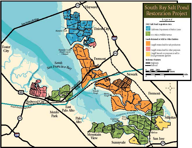
- Project Maps
- Mission, Goals, Guiding Principles, and Objectives
- Background on Habitat Conversion Model
- NSP Recommendations Report from July 10-11 meeting, and PMT Responses
- Science Strategy and Conceptual Model
- Stakeholder Assessment Executive Summary with Organizational Structure and Stakeholder Forum Information
- Annual Project Report and Future Project Schedules
- Read-aheads for Project Updates
Includes:- Alameda Creek
- Bair Island
- Eden Landing
- Lower Guadalupe River
- Pond A4
- USGS Data Collection
- Initial Stewardship Plan
July 10 and 11, 2003
- Agenda (PDF)
- Summary of Recommendations (July 2003, PDF)
- Project Management Team response to Recommendations (September 2003, PDF)
Background Material
- Overview Presentation (PDF)
- Draft Guiding Principles, Objectives, and Conceptual Model (PDF)
- Spreadsheet of Regional Planning Documents (PDF)
- Baylands Ecosystem Habitat Goals Report (PDF)
- Feasibility Analysis of South Bay Salt Pond Restoration, San Francisco Estuary, California by Stuart W. Siegel and Philip A.M. Bachand. 2002.(PDF)
- Datagaps Workshop Materials (See March 2003 Datagaps Workshop)
- Public Workshop Materials (See April 2003 Public Workshops).
 Google Map