
Interactive Project Map
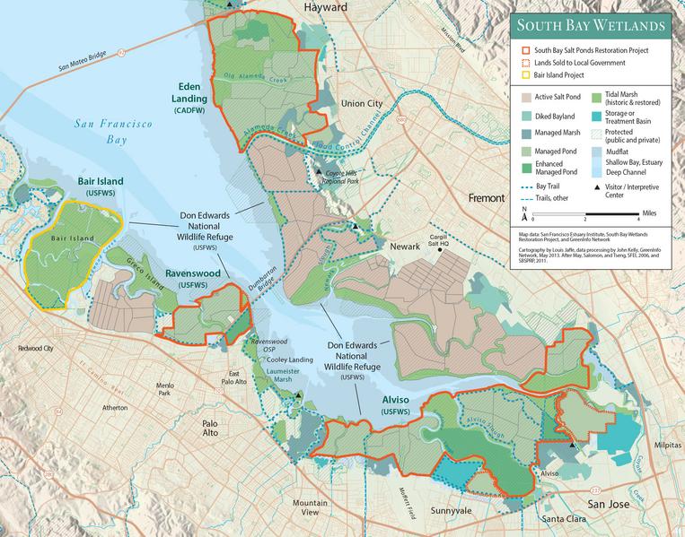
South Bay Wetlands 2013 (Bay Nature)
For original map, click Bay Nature Map
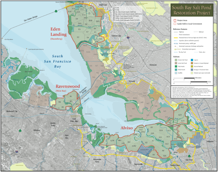
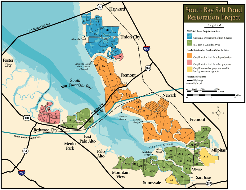
Detailed Project Map (May 30, 2006; updated June 29, 2011)
Download the Detailed Project map (11 MB PDF; see preview below). This map should be printed on paper at least 11 x 17 inches for the text to be legible.
This map contains the definitive pond ID system (June 2011).
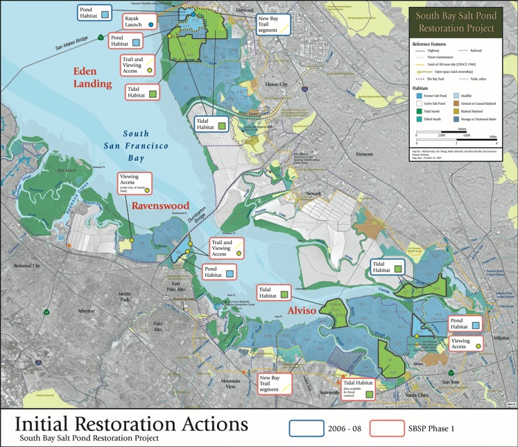
Initial Actions Map (October 25, 2007)
Download the Initial Actions Map (7 MB PDF; see preview below). This map should be printed on paper at least 11 x 17 inches for the text to be legible.
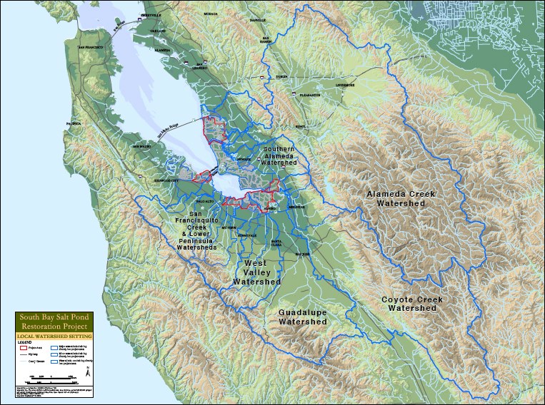
Watershed Map (September 16, 2004)
Download the Watershed Map (25 MB PDF; see preview below). This map should be printed on paper at least 11 x 17 inches for the text to be legible.
Overview Project Map (2003)
View or download Overview Project Map as a PDF file (125K)
Additional maps
Additional, more specialized maps are available in Documents and Events.