Phase 2 Construction Underway
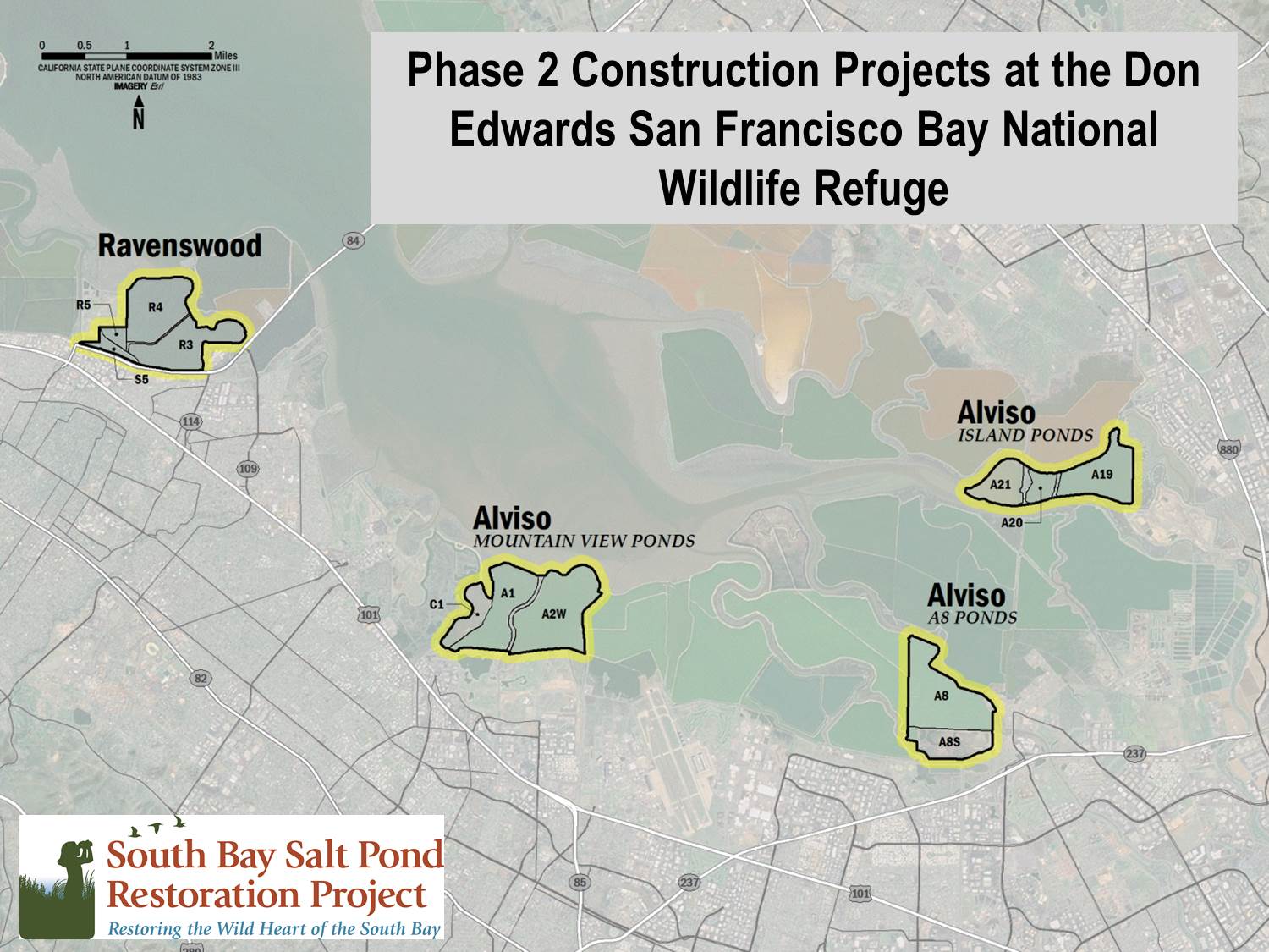
Alviso
Mountain View Habitat, Trails and Flood Protection Work
Workers have started construction at the 700-acre Mountain View ponds, which will host two new public trails, new bird nesting islands and a habitat slope that will also protect Shoreline Park from erosion. The former industrial salt ponds will eventually be opened to the Bay so nature can restore a rich tapestry of tidal marsh, channels and mudflats. The Restoration Project construction will also strengthen levees where needed to ensure flood risks are not increased. The City of Mountain View will also install erosion protection at key junctures with Shoreline Park edges.
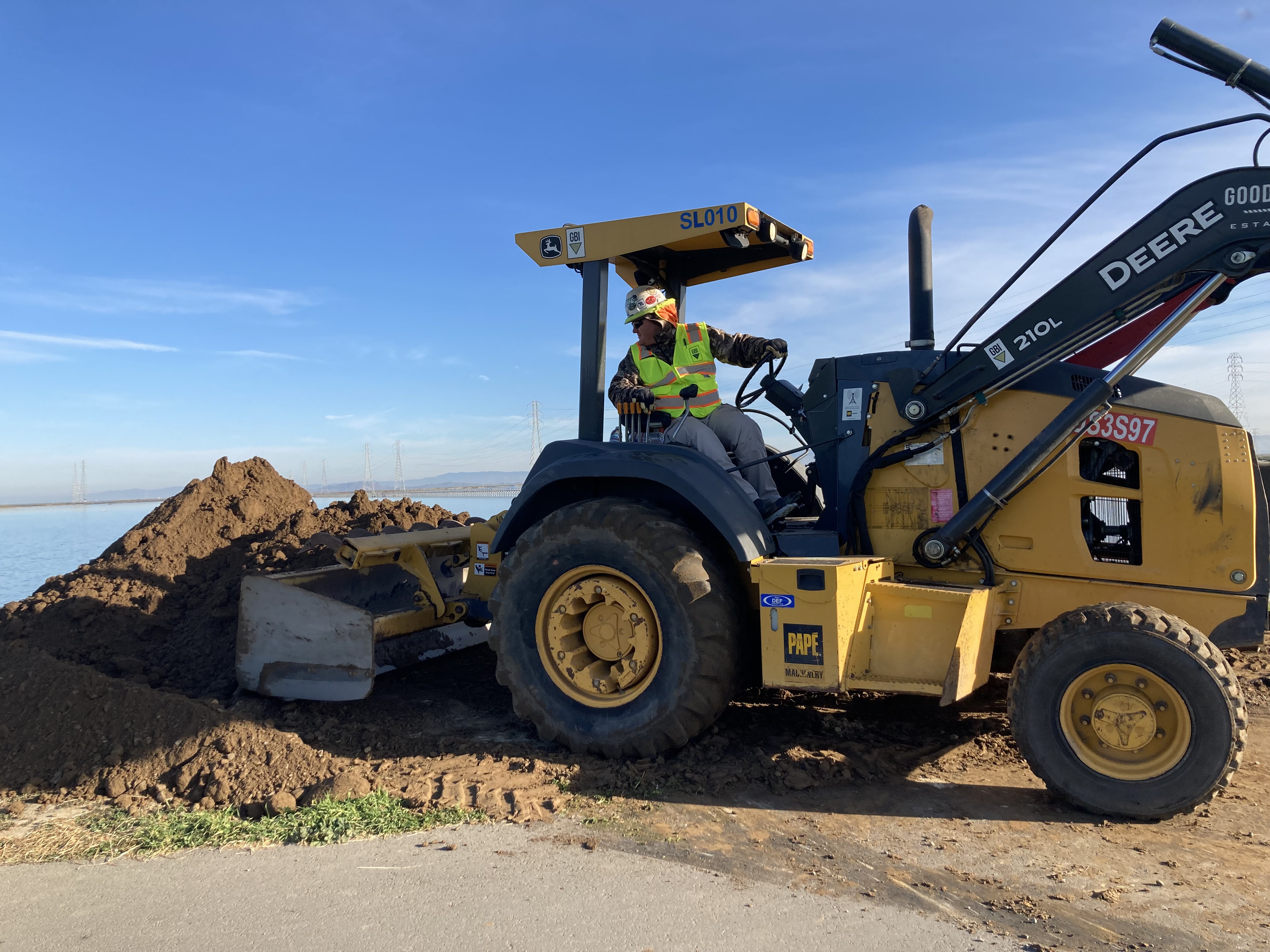
Trail Closures and Disruptions for Alviso Construction
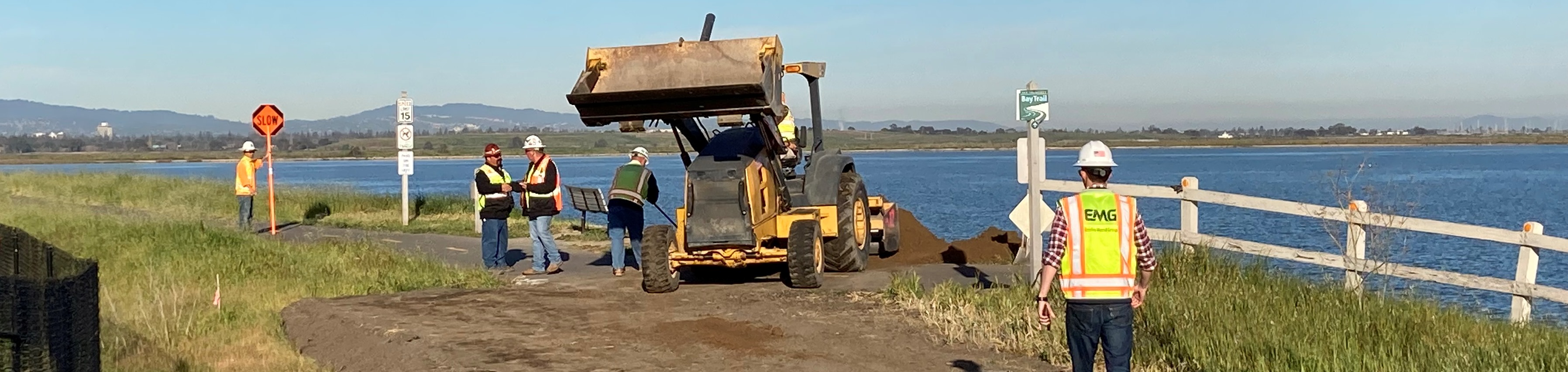
Construction and trucks are impacting trails, including the San Francisco Bay Trail, in Mountain View and near the community of Alviso.
Mountain View Shoreline
San Francisco Bay Trail and Shoreline at Mountain View park:
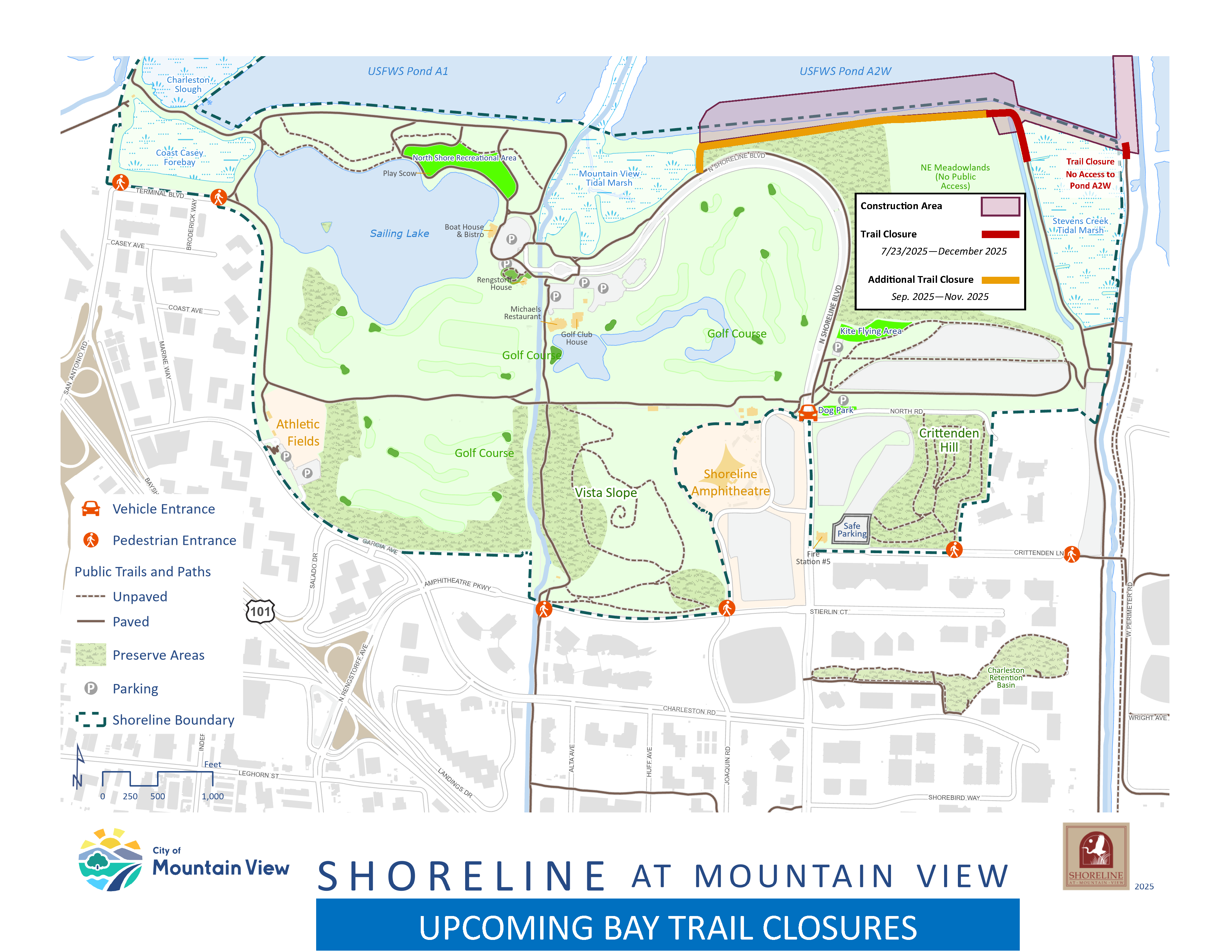
- Pond shore near golf course: Users of a paved portion of the Bay Trail bordering Pond A2W between Stevens Creek and Mountain View Slough will need to bypass trail closures due to construction, using the trail network at Shoreline at Mountain View regional park. Other Shoreline Park trails may be briefly closed as trucks cross. See map below for trail closure areas. Construction will occur between 7:30 a.m. and 4 p.m. weekdays, but trails will be continuously closed, including weekends. When: Summer 2025 through the end of 2025.
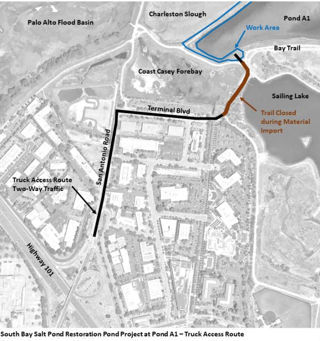
- By Sailing Lake and Charleston Slough: Trucks may cause daily interruptions and brief closings of a trail on the west end of the Sailing Lake and a nearby portion of the Bay Trail as the trucks use the trail or cross. Public trails will remain open to walkers and bikers on weekends, and during weekday times when no hauling or construction is occurring. Trucks traverse Mountain View Shoreline Park along the west side of the Sailing Lake and cross the nearby Bay Trail. They may operate between 7:30 AM and 4 PM weekdays. See map below for truck route. When: from late 2024 through 2027.
Alviso Marina and Environmental Education Center
Mallard Slough Trail is closed due to construction as well as sections of Alviso Slough Trail as workers complete a flood-protection levee in the Bay as part of the South San Francisco Bay Shoreline Project. The 4-mile-long levee, once completed, will protect north San José, including the community of Alviso and the Regional Wastewater Facility, from rising seas and a 100-year coastal storm. Work is Monday through Friday, 7 a.m. to 5:30 p.m. and on weekends as necessary, except holidays. There will be no public access to trail users across the Pond A12, A13 and A16 levees within the construction work area. See Valley Water's webpage for more information.
When: Construction is expected to finish summer 2025.
Mountain View Pond A2W Trail Impact Map
Mountain View Pond A1 Construction Vehicle Route
Don Edwards Phase 2 Construction Projects
Phase 2 Construction Completed and Celebrated
Ravenswood
The new Flyway Trail and Viewing Area was unveiled October 2024, connecting the City of Menlo Park's Bedwell Bayfront Park with the new Meta pedestrian bridge along the Bayfront Expressway. The opening of the half-mile trail at the U.S. Fish and Wildlife Service’s Refuge completes the Restoration Project’s Phase 2 construction at this 300-acre area of the Ravenswood Ponds. The trail provides views of ponds for ducks and shorebirds on one side, and the birdlife and newly restoring wetlands at Pond R4, which the Restoration Project breached to the Bay in December 2023.
- See television show Open Road's coverage of the breaching of Pond R4
- See our video on the breach
- See drone video selections of the breach by drone photographer Jack Morris
- Partnering non-profit Save The Bay is nurturing vegetation on our constructed habitat slopes along Pond R4 – read about it here.


Eden Landing Planning
Design and Permitting Work Underway
Project managers are developing post-planning construction designs and seeking to obtain regulatory permits to allow for the start of construction. Stay tuned for more news in 2026.
Eden Landing Phase 2 Final Environmental Impact Report
The final document, released in spring 2019, describes the preferred plan for tidal marsh restoration, wildlife habitat improvements, new trails and flood protection on 2,270 acres of ponds near Union City. It analyzes environmental impacts of alternative plans for the area covering about half of the California Department of Fish and Wildlife’s Eden Landing Ecological Reserve. This final report also includes responses to public and stakeholder comments received on the Spring 2018 draft report.
Download the Final Document
Information on the alternatives:
See the website Planning Documents section for other Eden Landing Phase 2 planning documents.
Alviso/Ravenswood Planning
The final environmental analysis document details Phase 2 plans for 2,400 acres of ponds in the Alviso area near San Jose and Mountain View, and the Ravenswood area near East Palo Alto/Menlo Park.
- To Download: You can download all or part of the final Environmental Impact Statement/Report here.